Thursday, July 29, 2010

Steamboat Springs to Lynx Pass Campground

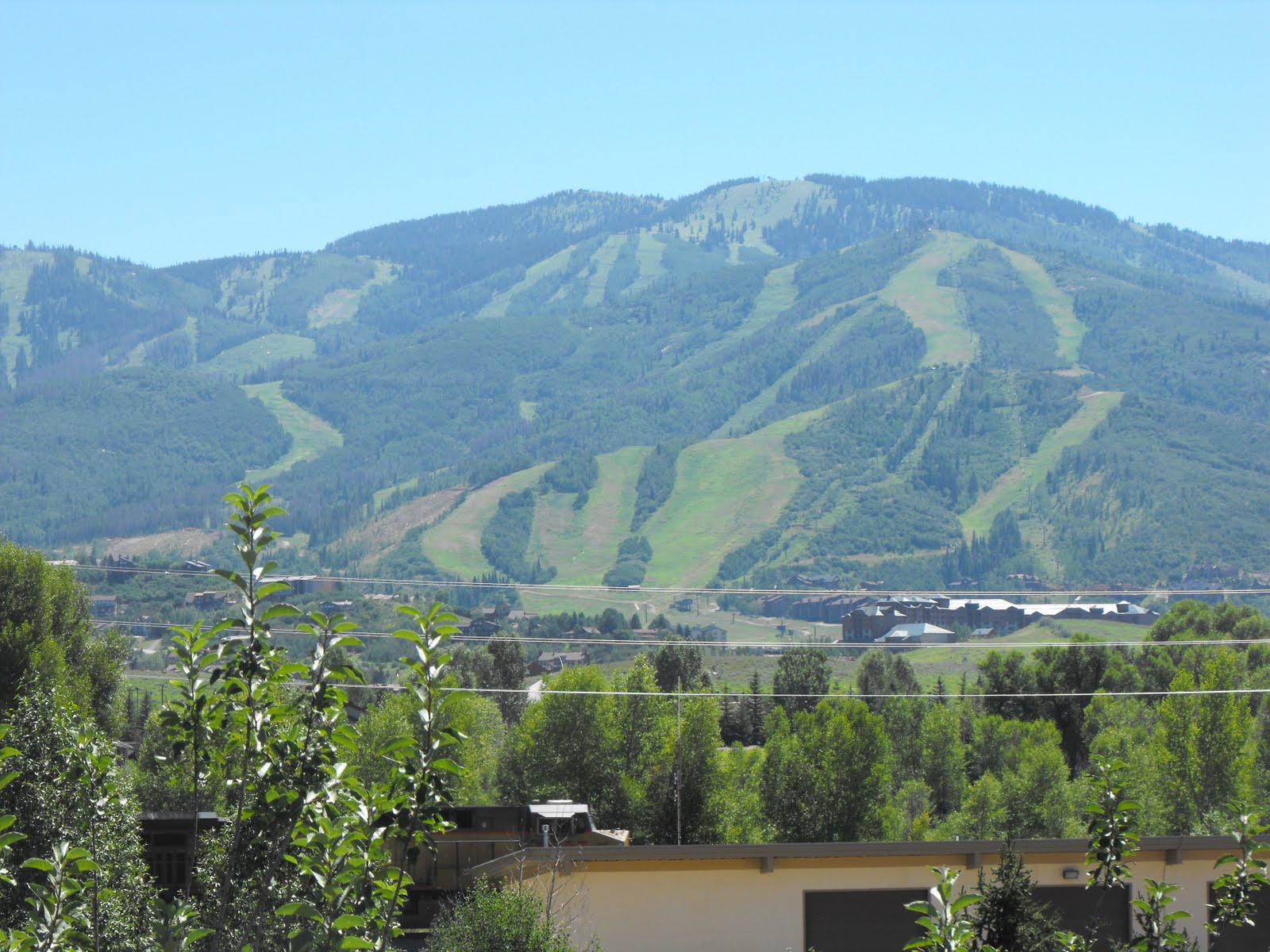
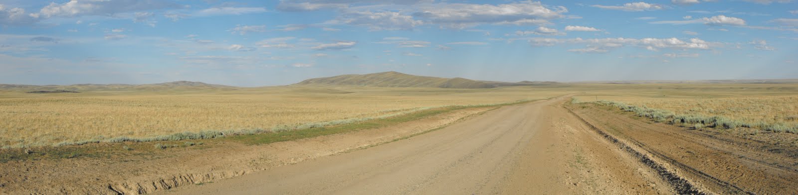
Today's mileage was initially 40 miles, thus I took my time to leave the town of Steamboat. I took a gander at the local farmer's market and took a scenic route to the start of my day. I passed over Yampa River, stopping to see everyone enjoying the beautiful weather as they floated down the river on inner tubes. I turned onto Howelsen Parkway, joining many other road bikers and was soon on gravel roads which would lead to Stagecoach Reservoir. Again, taking my time to take pictures, I was certain that the last 20 miles and 1500ft of climbing would be fairly easy. As I left the dam at the reservoir, my derailleur started to chew up the chain and I knew that I had a problem. I took the trailer off and tried some trail side maintenance, this was all to no avail and my only option was to leave the trailer and head back into town. I was still able to peddle, although I was unable to stop peddling, racing down the hills with my legs outstretched as the peddles rotated furiously. As I reached Route 131 I stopped to check the derailleur and saw that I had a fracture that circumvented the inner axle of my wheel. Luckily, passers by saw my anguish and were extremely kind in offering me (and my broken steed) a ride back to Steamboat. The bike shop knew me well as I had stopped in at least three times in the past two days and were quick to resolve the problem. With a new wheel and time ticking away, I had to race back 20 miles to my trailer. I reached the dam and my trailer at 6pm and still had 20 miles and the climb to go. I wasted no time getting back on trail and headed off on a 3 hour climb up to Lynx Pass (8937ft). I arrived at the campsite around 9.15 to find that it had been closed due to the beetle damage in the area, just another curve ball on an already difficult day. Thankfully, I had met two other riders when I had turned back to town and they had heard me pull in. They offered my their leftovers and we camped in the Lynx Pass campground anyways. It was actually a really nice campground, offering an outhouse and water pump. A long day was rewarded with some great sleep and campfire conversation.

Miles: 60

Steamboat Lake to Steamboat

Thunderstorms...a new obstacle, it did not dampen my spirits although it did dampen my sleeping bag. Either the tent is not 100% waterproof, or it came in through the rain fly. O well..it just took a little longer to leave camp. Most of today was spent on Route 129, as I coasted (mostly downhill) into Steamboat. I was able to nab the only campsite with a shelter and electricity at the Steamboat RV park, and my neighbors (also teachers) offered me a ride into town. The skies had not brightened from the night before and I did not look forward to another night of storms. I had dinner at the Mahogany Ridge Brewery, and saw the practice round for the ensuing night's rodeo. A relaxing day overall and I looked forward to spending the next day in town as well.

Miles: 30

Wednesday, July 28, 2010

Breckenridge Colorado

Its nice and early, my body is primed from a large pasta dinner last night and I have an "easy" 1800ft climb ahead of me. I will be passing over 11455ft, the second highest elevation on the trip so far. I will also be ending my adventure today, unfortunately it is the most sensible option, otherwise I will have very little time to rest and prep for the upcoming school year in Connecticut. I am headed over to Como, and from there will make my way to Denver. From there I will hopefully have the time to update my journey so far. It has been an amazing experience, a multitude of trail magic, and a bag full of challenges. I look forward to finishing the ride at the next opportunity and hope that everyone has enjoyed tagging along. Thank you very much for everyones help, hospitality and generosity!

Published with Blogger-droid v1.4.8

Monday, July 26, 2010

Aspen Alley to Steamboat Lake


I had caught up with another GDMBR rider and we left the campsite within minutes of each other, both deciding that we would take the alternate to Steamboat. The alternate was no second choice to the gorgeous scenery and would pass through the town of Columbine. The ride started out on forest roads and pass through Aspen Alley, a tourist attraction with the foliage in the Fall. A quick jaunt down State Highway 70 was int erupted by a large herd of cattle in the middle of the road, and a nice interpretive sign on the nearby Battle Mountain. I was soon off on gravel roads again, and a long climb to Columbine, questioned my ability to reach the town of Steamboat Springs. Once I reached Columbine, I headed for the Steamboat Lake Visitors Center to get a camping permit. Unfortunately it had closed by the time I arrived and a thunderous echo in the distance meant that it was time to eat and seek cover. I headed for a small cafe at the northern end of the lake, not only to eat but gain information on camping. As I sat there and ate my burger, 3 tacos, bowl of fries, 4 sodas, and gelato sandwich the heavens opened and I was glad to be inside. Once the rain had abated I headed for the Steamboat Lake campsite, unfortunately the storms were not over for the day, and it rained early into the morning. With little sleep, I was still able to get an early start the next morning as I headed into Steamboat.

Miles: 50

Saturday, July 24, 2010

Rawlins to Campsite near Aspen Alley

I had 135 miles and three days to plan for, with no real services until I reached Steamboat Springs. Unfortunately I was unable to leave Rawlins until around 1pm, and this was mostly due to the fact that I had to wait until the local Murray's bike store opened. Once my bike was back to health, I headed out with the intentions of reaching the campsite, with a decent mileage ahead of me. The first 25 miles were on pavement, but this soon turned to gravel and forest roads. Once I hit the gravel, the road started to climb as I headed to Middlewood Hill (7965ft). I was within the Sierra Madre Range of the Medicine Bow National Forest, and would have my 14th divide crossing of the trip. This did require a 6 mile climb, and unfortunately I had to dismount a few times to crest this. The roller coaster terrain (with a few difficult downhills) lead me further into the national forest, and the landscape was soon littered with trees, a sight which had been lacking for the last week or so. The last 5 miles were particularly grueling as the road turned to sand, and limited traction was certainly a psychological distraction. I reached the primitive campsite around 9pm, and was quick to set up my tent and get some rest.

Miles: 50

Friday, July 23, 2010

Sweetwater River Crossing to Rawlins


Technically this post encompasses two days, but it was two of the hardest days so far. Thankfully the onslaught of mosquitoes had subsided as I packed up my tent for the ensuing 68 mile ride. An early start (8.30'ish) seemed to be fruitful as I found out that most of the ride would be relatively flat, and I quickly pumped out the first 10 miles. My joy quickly subsided as my rear wheel starting to slide beneath me, and it did not take long to see that this would be a very long day. No amount of duck tape (no it does not fix everything), patches, glue, plastic cement would cure this ailment. And I resorted to foot power. Exhausted and in pain, I followed the route for 20 miles, the sun had decided that the day was over and I camped on the side of the road. This stretch to Rawlin's lies within the Wyoming Basin, a desert sea in which water is hard to come by. I was not able to rely on any water source on the map and went to bed with less than half a water bottle full of water. I awoke even earlier the next morning, 30 miles from a reliable water source and knew that my plan for the day had to change. Thankfully Green Mountain to the north is aptly named "Green" Mountain due to the fact that it has trees in this barren landscape. I headed off route making all decision's based on the landscape and maps which did not show the topography. I was able to find a trickling stream and other sources of water, although I only filtered their water due to the dire circumstances. I added iodine for the first time due to my dislike for obvious location of the water. My only chance was to head for the saddle between Green Mountain and try to locate Jeffrey City. It was a hard and long uphill battle with no two track to guide me. As I reached the summit of Green Mountain I saw (what I thought was..) Route 287 in the distance and hoped that the nearby town was Jeffrey City. After pushing the bike for close to 20 miles I reached the flats to Jeffrey City, another undulating 10 miles put me on the outskirts of this seemingly populated oasis. I was quick to realize that this "oasis" thrived in the 1970's when there was a uranium boom in the area. The houses had boarded windows and the map's population of 1800 was more fitting for the amount of crickets. I was fortunate to meet a man named Otis who provided fresh water and guidance to the locals. With little strength and barely the ability to talk I sought the local motel for respite. After looking in some of the windows this was clearly not an option, and all that the local water hole would offer was a ham and cheese sandwich. Four cans of soda and "that" ham and cheese sandwich later, I struck up a conversation with Zack Larson who had driven out from Laramie for some photo opportunities. I had been planning to hitch a ride to Rawlin's the next morning, but Zach was an absolute life saver as he offered to get me to Rawlin's that night. By now the time was near 10pm and we had a 50 miles drive ahead of us. Zach's gas and Mountain Dew were on me, and so were my thanks as we headed to Rawlins.

Tuesday, July 20, 2010

Little Sandy to Sweetwater River Crossing


Part of today's ride traversed the Continental Divide, with three official crossings. I continued on the dusty gravel roads to State Highway 28, knowing that I had to be careful since the posted speed limits for vehicles is around 65 on these roads. Once I hit the highway there was a small rest stop, with an interpretive sign on the Oregon and Mormon Trail emigrants of South Pass (7550 ft). A small climb to climb between the Atlantic and Pacific Watersheds led me to South Pass city, where a small general store provide an ice cold Sarsaparilla. It was on to Atlantic City with a wonderful (a short) descent into this small town, upon arrival I found that my steed had succumbed to its first flat (a bad sign of times to come). I met a fellow GDMBR rider and we sat to share stories, eat, eat, eat and fix the flat. Many others on the GDMBR use this stop as a place to refuel, and Travis Pastrana spent the night here on his journey as well. With a PB&J to go, I was off for the remaining 10 miles to Sweetwater River, a difficult climb out of the city led to a quick ride to the intended campsite. In the short 10 miles I met three sets of CDT hikers, and then had to have a record set up time with my tent due to the unrelenting attacks from mosquitoes.

Miles: 48

Monday, July 19, 2010

Pinedal t o Little Sandy Creek Campsite

I needed to make sure that I was stocked up for 4 days, as Rawlins was 220 miles away. And there were limited services en route. I also needed to take into account that there would also be limited opportunities to re-supply water. I continued to sweep by the Wind River Range and it was not long before I arrived in Boulder, a quick rest was all that was needed in Boulder and I headed east into the (Jim) Bridger Wilderness. I was aware that these four days would be some of the most wild and remote times that I have (and will) see on this journey, but this route had served as a Continental Divide crossing for early nineteenth century explorers and emigrants. If their wooden wagons could accomplish it, so could I. It was a relatively easy journey despite the roller coaster terrain and I had help from a passing motorist who was insistent that he gave me water for the ride. I arrived at Little Sandy and found that a local outfitters (http://www.blueskysage.com) also had rights to the very primitive campsite, they welcomed me (and knew of many others who have attempted such an expedition) and invited me over for dinner! So thank you to Bobbi, Mike "the cowboy", Emily and Cade (who was from Alaska and does not ride polar bears in case you were wondering). As I crossed the gravel road to set up camp for the night, a thunderous sound ensued, and before I knew it an SUV had rolled over into a nearby ditch. This SUV had been pulling another truck down the rocky slope and lost control, everyone way okay but I quickly sought Mike and Bobby's help since I was in the middle of nowhere and without service. All of the passengers were safe (including a 1 year old) and with the help of local cowboys, passers by and the county sheriff we took care of the situation. After the chaotic start to the evening, we sat down for amazing bison tacos and great hospitality.

Miles: 47

Crooked "Criked" Creek to Pinedale


Santa Claus....wait, sorry the rambunctious black bear had chosen to see what was in the dumpsters. And after the burger from the night before I cannot blame him. So I set off to climb Union Pass, a difficult climb up to 9258ft. I had also decided that I would advance to Pinedale, a mere 70 miles away. It took over an hour and a half to travel the first 6 miles to the peak, and then the winds picked up. I cannot even hazard a guess at their strength, but at time I was unable to steer my steed. As a side note, this was my 8th CD crossing, and a Pass which had been christened in 1860 by explorer Capt. William F. Raynolds. The first 40 miles placed me in the middle of the Wind River, Absaroka and Gros Ventre ranges (hence "Union" Pass), and spat me out in the Green River Valley. The terrain consisted of rocky gravel roads and I questioned my ability to reach Pinedale. Constant thoughts of McDonald's actually kept me going, although little did I know that McDonald's vast empire does not reach Pinedale WY. Once I reached Whiskey Grove campground (where I should have camped), I found that the whole of Green River Valley had been closed to camping due to recent griz activity. It was 3 o'clock and I had 30 miles of pavement ahead of me. By far my hardest day, as I barely had any energy to check into the RV campground in Pinedale, although a second wind made sure that I visited the Pinedale Brewery for dinner. I would stay a day in Pinedale, as my rear wheel was "out of true", and my incoherence after today's ride needed to be fixed as well!

Miles: 70

"TOE-gut-tee" to Warm Springs Creek Area


The "fun" 4 mile climb had been tackled the night before, yet I still had to climb up to Togwotee Pass (9658ft) and a steady 9'ish mile climb. Part of this climb was facilitated by pilot cars since highway 26/278 was under construction, and obviously I was not able to keep up with the one lane of traffic. Although this was helpful, I still need to detach the BOB and load my gear into the truck on two separate occasions. A scenic loop around Brooks Lake provided a respite from the highway, which was followed by decent descent towards the ominous Union Pass (9210ft). A quick stop at a gas station provided ginger ale and fig newtons, along with a nice conversation with a fellow bicyclist. From the descent, I had lost all of the elevation that I had happily tucked under my belt, so I decided to take the alternate (3.5 miles longer) to the pass. This would make the ascent easier although the ensuing three hills took their toll, actually only the last did. The Warm Springs campground seemed inviting although I saw that a nearby guest ranch also offered the opportunity to camp. Crooked Creek Ranch also offered food! and a Frisbee Golf course! but no camping, only because they had a very boisterous black bear that was in the area. I was offered a cheap rate on a motel room and one of the best burgers that I have had on the trip so far. I went to bed, and like a child on Christmas Eve I eagerly awaited the next morning. Hopefully the door to the bear trap would be closed!

Miles: 45

Thursday, July 15, 2010

Flagg Ranch to Togwotee

Although most of today was spent skirting the breakdown lane of highways, I was also skirting the dramatic eastern slope of the Teton Range. Running parallel to Jackson Lake at the beginning of the day, I had to be careful not to stop too many times for photo opportunities. I turned at Moran Junction, heading away from Jackson and set off on Buffalo road which would lead me to Turpin Meadows. Upon arrival, I still had the ambition and energy to keep the day moving. Little did I know that this would involve a 1500ft climb with the first of 4 miles on forest roads. Even so, my intentions lead me to Togwotee Ranch, and there was a primitive campground with my name on it. I had the ability to pay for a shower and sit down for a hot meal. That was after relaying my story to 30 middle school kids, 30 times. With 8 miles less to do the next day I felt comfortable that I could manage the ensuing 40 miles.

Miles: 48

Wednesday, July 14, 2010

Warm River Camground to Flagg Ranch


Another early start as I was peddling by 9am, and looking forward to the day. The mileage was a meager 48 miles and I thought nothing of it. After 10 miles of rolling grain and potato fields, I switched to dusty forest trails. Climbing over 1800ft, I tried to keep my eyes off the speedometer, as the mileage never seemed to change. My rear wheel seemed exhausted as it grasped for friction with the loose and sandy forest roads. It was an extremely tough day, mixed emotions constantly filled my forethought as I battled my way around the Northern Flank of Les Trois Tetons. Also named the "The Pilots Knobs" by earlier explorers. I unknowingly passed into Wyoming, and only cared that I would finish the day before sunset. The day was spent washing down the dust from my throat and wiping the sweat from my face. The Tetons did provide a nice backdrop to today's ride as I skirted around the Yellowstone border, but the rugged roads kept my thoughts from the inspirational scenery. I arrived at the industrial strength Flagg Ranch, with little strength to spare although full of gratitude for my performance on the day. I was in need of a good nights rest and took comfort that they had only one room left.

Friday, July 9, 2010

Upper Lake Campground to Big Springs...actually Warm River


Since I was awake and out of "sleeping bag" at 7, I had no reason not to set off by 8.30, although the intended mileage was around 30 miles for the day. The day before, I had come to the
realization that my barometer and elevation marker was off by 1000ft!, not sure when this happened, and not sure whether or not it was actually comforting. But I re-calibrated it at Red Rock Pass (7120ft) which is also the border of Montana and Idaho. Finally finished with Montana!! It was a short but steep climb up to the pass, and a welcoming descent down to Henry's Lake. I arrived at Big Springs before 1pm and decided that it would be a waste to stop at that point. I refueled at the local grocery store, again eating too much and regretting it for the next 10 miles. I choose to head to Warm River via Route 20 and the Mesa Falls Byway. Knowing that this would put the days mileage near 60. As you may see from the GPS points I did stop halfway (I was not lost) but there was a local craft fair, which also provided rest for the legs. I turned onto the Mesa Falls Byway, which is a more scenic route to Ashton. Again another stop at the Lower Mesa Falls provided an opportunity for rest and pictures. My legs were hoping that the day would end and it was another 5 miles to the Warm River campground. Upon arrival, the "campground full" sign was disheartening, although Velma (the host) and her husband (Lynn) were absolutely amazing and found me a spot next to them. I was welcomed into their trailer for chili, and we shared stories until it was time for me to part ways for the night. This campground is certainly the best National Forest Service campground, which is in agreement with Micheal McCoys "Cycling the Great Divide" book. Slight showers did not dampen my nights sleep, and when I awoke I was again welcomed to their trailer for the morning's libation of caffeine. Thank you again for your generosity and kindness.

Miles: 60 (or 59.89)

Thursday, July 8, 2010

Lima to Upper Lake Campground


Still getting used to the long mileage and this day would be the longest I have ridden by far, especially since it was all off road. After 14 miles I passed the Lima reservoir and entered the desiccated countryside, traveling on gravel and dirt roads. As I entered the Red Rock Wildlife Refuge the scenery changed, I entered the wetlands and started to see forests again. The Red Rocks NWR was created for the protection and propagation of the trumpeter swan, this location is the only viable population of trumpeter swans in the entire U.S. I was also amazed to see a white pelican, and later found out that this was not a mistake. I stopped at the Lakeview Guest Ranch to have a quick chat and use their sprinklers to refill my water bottles. And quickly finished the remaining 5 miles to Upper Lake. A natural spring at the campground provided me with more than enough potable water and it was not long before I was joined by two others who were also doing the GDMBR, albeit on motorcycles. Somewhat jealous that I would only take them 13 days or so, we shared our stories and it certainly made the middle of nowhere feel a lot better. As a side not the mosquitoes at this campground were viscous and it forced me inside my tent by 8.30pm. Good luck to Isaac and his dad on the rest of their travels.

Miles: 55

Wednesday, July 7, 2010

Bannack State Park to Lima


An early start again, I tried the visitors center for some hot water only to find that they did not open until 10am (it was my recollection that it was open at 8am). By the way, depending on my mood, I average a 45 min pack up time every morning. I headed off on the hilly, dusty and washboarded (still do not know that physical process which causes the roads to be like
this) road and felt the desertification of southern Montana. It was easy traveling over the Bannack Bench and I chose to head towards Route 15 to lengthen the day. Heading down Route 15, I stopped in Dell at the famous "Yesterdays Calf A" and chowed down a BLT and Dr. Pepper. I am always hungry but have to be careful when and how much I eat. Particularly when I still have decent mileage to go. The BLT tasted great although it made me eager to reach Lima. After camping for the last 3 nights I chose to stay at a motel and get everything clean again. The hosts were more that hospitable as they were well aware of the GDMBR, they gave me the largest room (actually had 4 beds in it) and I was able to get all of my laundry done. I headed out for some protein, and stopped at one of two restaurants in town. Here I was able to cook my own rib-eye with sides of salad, Texas toast and a baked potato. I barely got any sleep (maybe 2 or 3 hours) and that was probably due to the fact that I had 55 miles to do the next day!

Miles 48

Tuesday, July 6, 2010

Little Joe to Bannack State Park


I awoke to a thin layer of frost coveting the view of my map, brushed quickly aside I ventured out of my tent to find that my water bottles had also frozen over night. Although I was not the first to get out of bed, I was the first to leave the campground. The ensuing 30 miles was mostly on pavement although a 6 mile climb greeted my morning slumber, I pushed and peddled my way past Elk Horn Hot Springs. The weather and the terrain made it tedious as I had to constantly stop and restart to put on an extra layer. Soon after noon I joined the TransAmerica Bicycle Trail (Virginia to Oregon), and headed down Country Road 278 to Bannack State Park. Bannack was named territorial capital in 1864, when the Montana Territory was split from the Idaho Territory. There is still a ghost town left from their mining heyday's. Since it was the last night that Dad would be in the area we took a ride to Dillon and saw the point where Lewis and Clarke triangulated their position, and then we had dinner at the Lions Den. An early night was needed for the next day as I planned to leapfrog to Lima (pronounced like the bean).

Miles: 38

Bannack State Park (Vigilante Campground)

Monday, July 5, 2010

Fleecer Ridge


The day started with a 6 mile climb, then bursting from the the trees I was confronted with the famous (or infamous) Fleecer Ridge. On the way up many had asked how I would arrive in Wise River and other said that I would "git her done". I arrived at the base of the ridge, out of breath and confident that I could at least push the bike up the ridge, and up the ridge, and up the ridge, all the way to 8000ft. All the way past my turning point to get off the ridge, and this is where I stayed for around an hour and a half. As you can see from the GPS, I never found the true way off the ridge. The "faded" path was certainly not there, and the barricade that I was meant to look for had fallen down. I did however see a road in the distance and since the ride to it was mentioned to be un-ridable I figured that I didn't have the strength to bushwhack over to it. So I took an equally strenuous path down the way I came and lost mileage for the day. I had to take the paved alternate to Wise River and arrived just in time to refuel at the only store in town. No reception made it tricky to link up with Dad, but we found each other and made it to Little Joe Campground.

Sunday, July 4, 2010

Butte to Beaver Dam Campground


A days rest certainly helped the knee and I feel refreshed as I set off for my 5th continental divide crossing. Much off the day was spent in high streamless country near the top of the Butte watershed, where camping is not allowed. Near the peak there was a nice view of Butte and also the Berkley Mining operation. Most of the day was spent rocky and dusty forests roads as I climbed up to the divide, this lead to a fast paced decent to route 15 and the big decision for the day. Would I take the alternate around the famous Fleecer Ridge or ride up to Beaver Dam campground and tackle the ridge in the morning? I decided to tackle the ridge, following the forest roads 6 miles into the mountains and settling down for the night.

Saturday, July 3, 2010

Boulder to Helena


Still continuing to follow the mapped "Boulder Alternate", I left Boulder and passed over the Boulder River onto the non maintained cattle access path, this paralleled route 15, and after a short 5 miles crossed over to the western side of the highway. Here I followed the trail high above the highway and maintained a steady elevation of around 6100ft. Not an easy trail, as recent rain and hail had caused rivers to burst their banks and sink holes to form in the trail. It started to cool down to 60 degrees as I entered Butte, but before I descended into Butte (or "Butte America" thanks to those in Boulder) I passed my second Continental Divide Crossing. A days rest is needed to work out a problem with my knee and plenty of icy hot will be applied to get it working again. The journey will continue tomorrow!! with 37 miles to Beaver Creek Campground, and an important decision with Fleecer Ridge looming in the distance.